
We return once again to the Nice to Digne metre-gauge line and continue our journey from La Mescla.We start at the La Mescla Station which was completed in 1904 to replace an earlier building which had been located about 500 metres further north. The next image shows the station which was abandonned in 1904, and the colour image shows the same site later in the life of the line. The road and the tunnel in the distance have been widened.
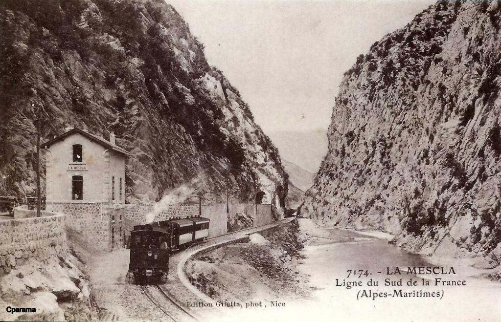
 Beyond La Mescla the railway continues to hug the river bank on the South West side of the River Var. The satellite image below shows the extent of quarry workings on the north bank of the river associated with Lafarge Bétons Centrale Malaussène (Construction Material Wholesaler)! Two bridges are visible in the satellite image. The first in the bottom right crosses both railway and river, the second appears to be an internal industrial bridge across the river.
 The route continues in a generally northwesterly direction for a distance of little more than a kilometre alongside the river, before turning to a more westerly alignment. The line continues to remain close to the River until crossed by the road as shown on the second image below.

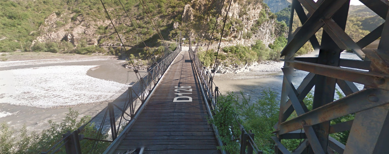
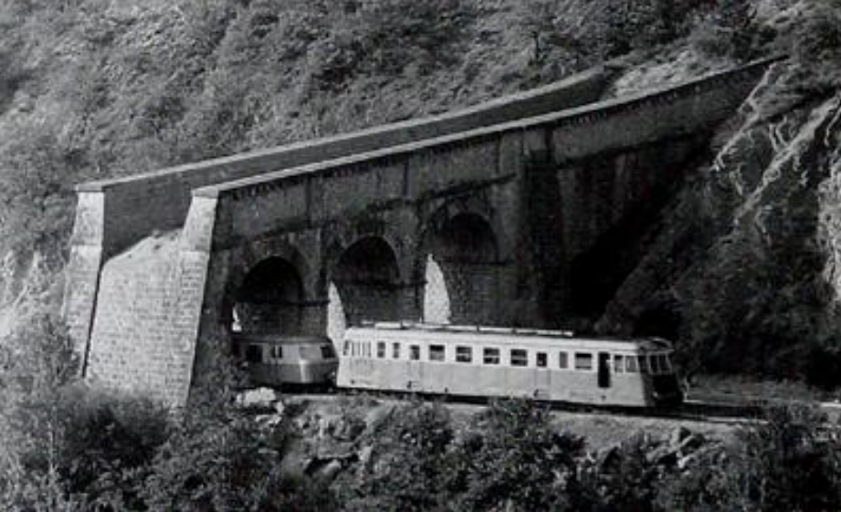
 The 50 metre span suspension bridge is Pont Auguste Dubois at Massoins has a maximum load capacity of 3 tonnes and it provides access for the D126 across the river to Massoins high above the river on the north bank. Malaussène holds a similar position on the south bank! Their shared station is in the valley floor on the south side of the river after the short tunnel known as Tunnel de Malaussène which is marked on the plan immediately above by the red and green dots. Early in the life of the line there was a crossing keepers cottage alongside the railway crossing at the eastern tunnel portal, as the Gilletta postcard below shows.
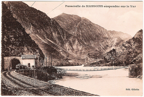
 The eastern portal of the Tunnel de Malaussène. [1]
 The western portal of the Tunnel de Malaussène is hidden beyond a road over-bridge and a myriad of road signs!
 A road underpass immediately before Malaussène Station.
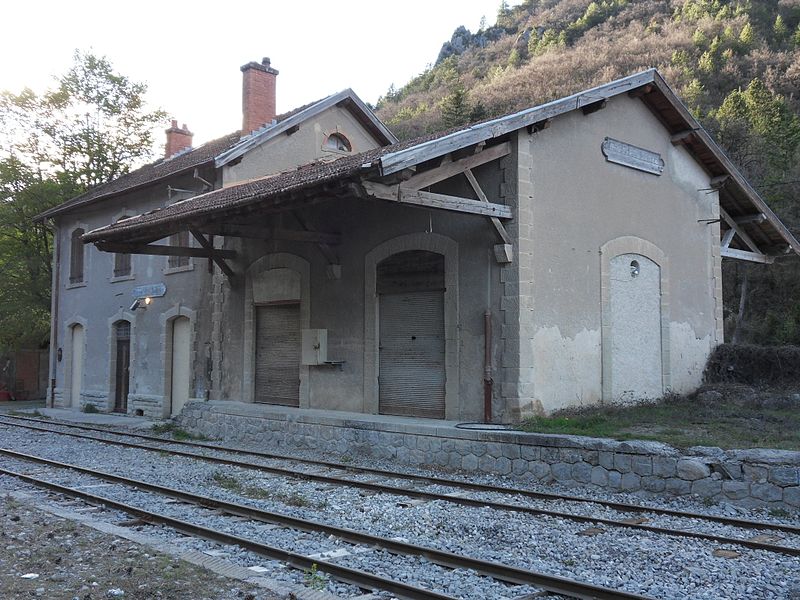
 La gare Malaussène, trackside. [2]
 La gare Malaussène, forecourt – hidden from the road by trees and a hedge. [2]
After La gare Malaussène, the railway drifts away from the road as it travels west across the flood plain. The road remains close to the River Var. The road (D6202) then swings away from the river to allow it to access a new bridge across the watercourse. As it does so, it alignment comes close once again to the railway, and road and railway cross the river in close proximity.
 The old road travelled along the south bank and under the railway bridge before crossing the river on a bridge which is now long-gone. The two shots immediately below show the old road bridge upstream of the railway bridge. The third picture below shows a goods train pulled by a diesel locomotive heading towards Nice. [6]


 Now on the north side of the valley, modern road and railway run closely in parallel until reaching Villars-sur-Var. The entrance to the station area is shown below.
 CP-X-304 arrives at Villars-sur-Var travelling towards Nice in 2016, (c) Kjell Strandberg. [3]
 Villars-sur-Var Station building in 2016, (c) Kjell Strandberg. [3]
 An aerial view of the station. [4]
 An overall view of the station site featuring the watertower. [5]
 A Renault Railcar at Villars-sur-Var Station. [6] And in the two images immediately below the station is shown with other railcars present. [7]

The final image of the station at Villars-sur-Var is taken from the road side in winter.
Travelling on from Villar-sur-Var the line closely follows the northern bank of the river as far as the station at Plan Souteyran. In that length of the line the river meanders back and forth and only very occasionally is the line more than 100 metres from the River Var.
The halt at Plan Souteyran is not evident on the ground and appears to have been destroyed. It sat between the railway and the old road as can be seen on the map and satellite image below and served a very small community on the river bank.
 The next halt was at Touet-sur-Var – Le Tournel, and came after another length of line hugging the north bank of the Var. There appears to be no evidence of this halt which may have been removed to allow for the modern road formation.
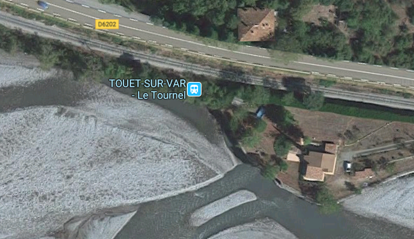 Just beyond the location of the halt is a small lattice truss bridge, typical of those crossing small streams along the line.
 Another kilometre or two along the line the railway entered the village of Touet-sur-Var. Its alignment can easily be picked out in the satellite image below. The village station can be seen to the left of the image.
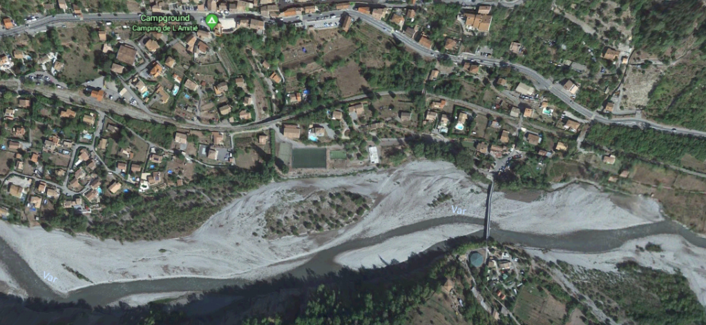

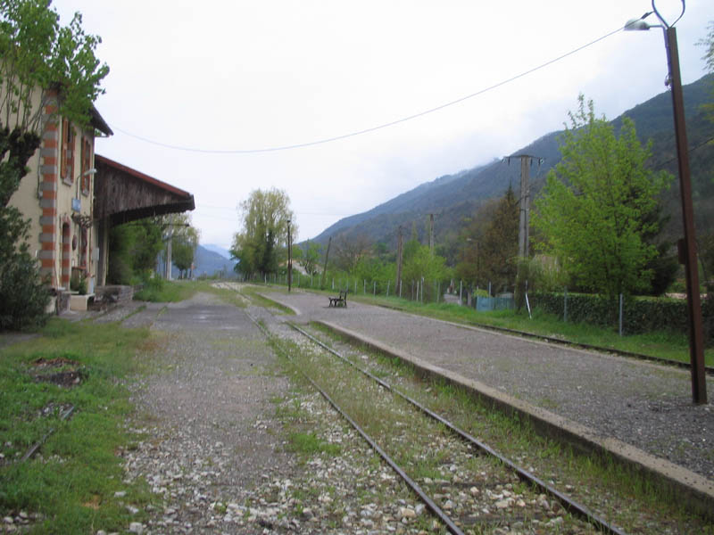
 The old village of Touet-sur-Var sits high above the more modern village which has formed around the railway station. [10]
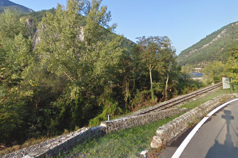
After Touet-sur-Var the line closely follows the river once again in a westerly direction, smaller lattice girder bridges carry the railway over tributaries of the Var, such as the one below which crosses Le Cians immediately before the halt of the same name.
 The Halt Shelter can just be picked out on the right side of the image above. Beyond l’Arret Cians the road, railway and river continue in close proximity, typically as below, until approaching Puget-Théniers.
 En-route to Puget-Théniers, the line once passed through a further three halts, of which there is no evidence of two in the early 21st Century. The third appears to to be no more than a sign and a length of railing alongside the main road into Puget-Théniers.
 The Station Approach, Puget-Théniers.
 A satellite plan of the whole station site including the GECP workshops.
 The station can be seen on the left of this elevated image of the village, adjacent to the river. [13]
 In another elevated image, the railway can be seen alongside the river. A train is entering the shot from the bottom (the East). [14]
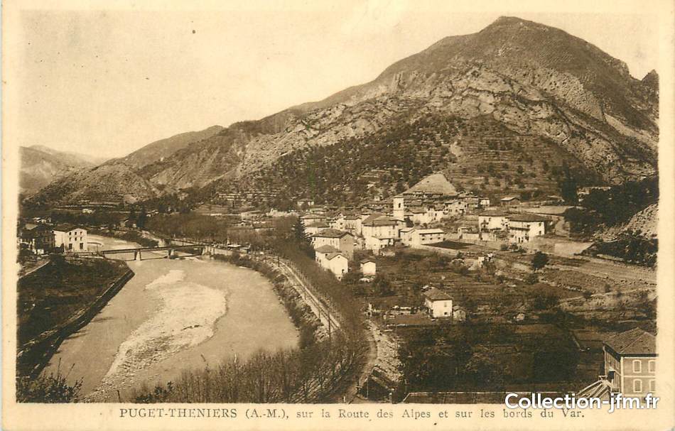 The railway is even more visible in this image. [15]
 Landslide on the approach to the village in 1960. [12]
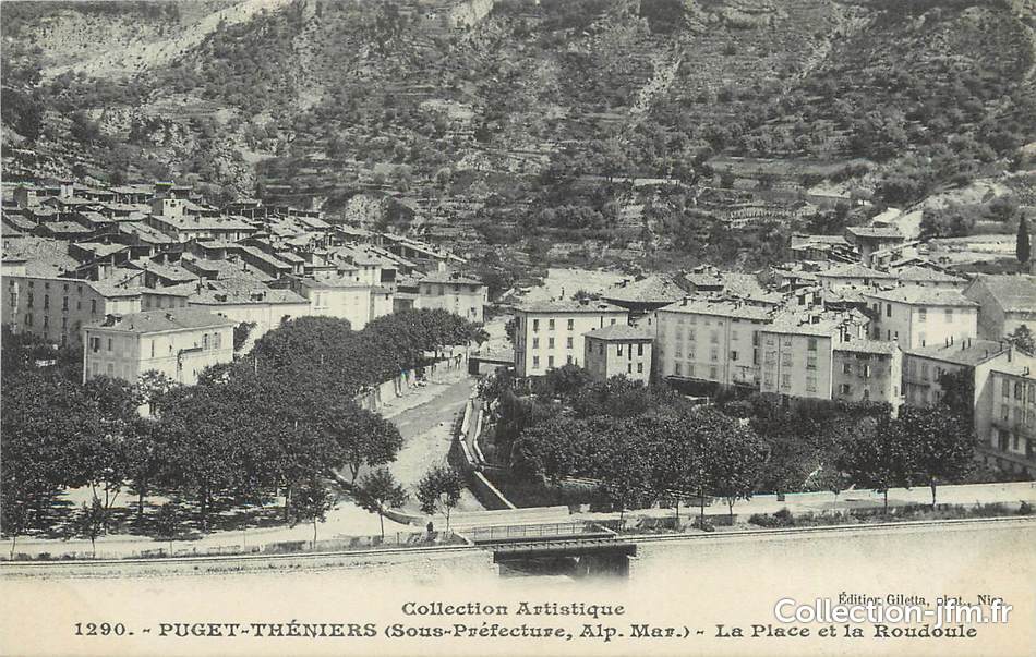 The railway is in the immediate foreground of this picture of Puget-Théniers. [16]
 Renault ZZ-06 and XR-1336 at the bridge shown in the postcard above at Puget-Théniers on 08/07/1987, (c) Photo Martijn Haman. [18]
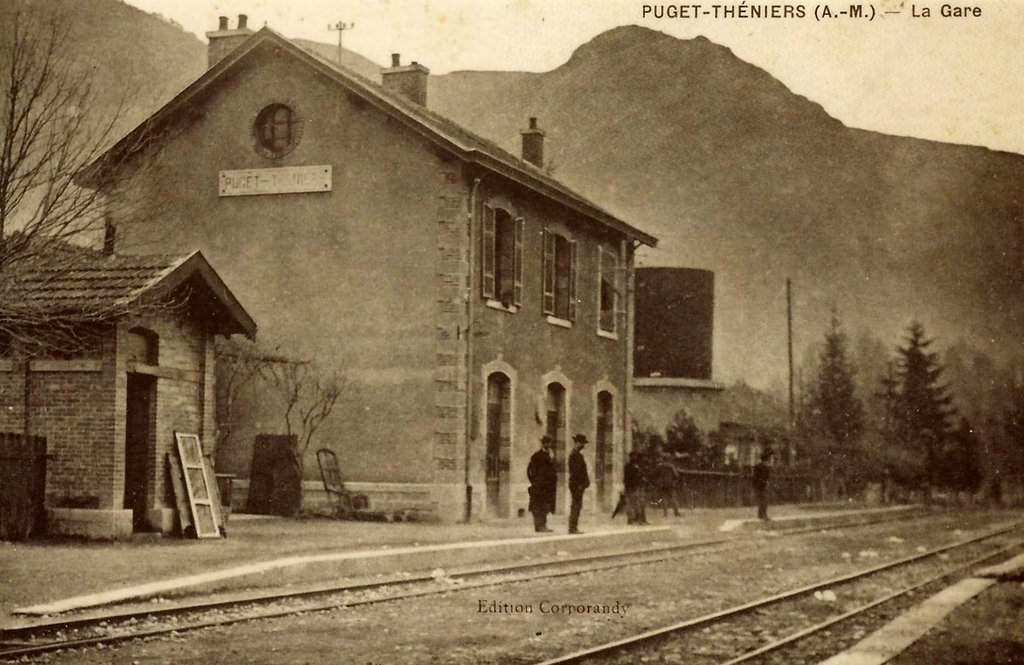 Old postcard of the station. [11]
 The station building early in the 21st Century. [17]
 SY 03 in Puget-Théniers on 07/07/1987, (c) Martijn Haman. [18] A later image is shown below. [19]
 Puget-Théniers is the headquarters of the GECP (Groupe d’Étude pour les Chemins de fer de Provence). The GECP was formed to: renovate and restore rolling stock and locomotives on the line; promote of the line of the Railways of Provence; operate the Train des Pignes à vapeur; and undertake Heritage Activities and Historical Research. [20]
 GECP’s workshops are in an old station building (above and below). [20][21]
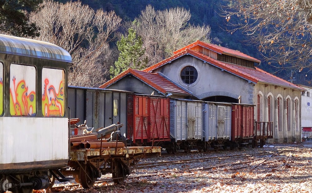
 The loco shed. [19]
 The new and the old together. [22]
The “Train des Pignes” operates out of Puget-Théniers on parts of the 151 km metre-gauge Chemins de fer de Provence (CP). The steam trains run by the GECP which was founded in 1975 when the line was seriously threatened with closure. Most trains operate to Annot (a distance of around 20 km), with an intermediate stop at Entrevaux, on select days from early May to early November and are hauled by ex-CP (Portugal) 2-4-0+0-6-0T Mallet E 211 (Henschel 19874/1923). In Portugal, the loco was in use out of Sernada on the Val de Vouga lines until 1975, out of Lousado from 1975 to 1976 and out of Regua on the Corgo line from 1976 to 1981. The loco was sold to the GECP in 1986, she first saw use on the CP between 1988 and 1992, after which she went through a major overhaul at the Lucato Termica workshops in Castelletto-Montferrato (Alessandria, Italy) only to return to service in 2010.
Prior to the arrival of the Portuguese Mallet, the GECP used ex-SNCF ‘Réseau Breton’ 4-6-0T E 327 (Fives-Lille 3582/1909) between 1980 and 1987, and again between 1993 and 2007. Before it came to the CP, it had been saved by FACS in 1967 and saw limited use on the Vivarais line between 1969 and 1979. Since 2007 it has been out-of-use and stored inside the shed at Puget-Théniers. It would need some major repair to work once again, but is not really adapted to the steep gradients. Also at Puget, GECP uses ex-SNCF ‘Blanc-Argent’ 0-6-0DM No. 11 (CFD Neuillé-Pont-Pierre 1940-41) as a shunter. Built on the frames of CFD Indre & Loire Nord 0-6-0T No. 8 (Couillet 1885), the little diesel first saw use on the CFD Indre & Loire Nord and Yonne lines, before being sold to the Blanc-Argent (BA) railway in 1952 and ending up with GECP in 1988. [23]
After leaving Puget-Théniers, heading west towards Digne-les-Bains, trains continues tofollow the river course. The railway, for about one kilometre, remains on the northside of the river.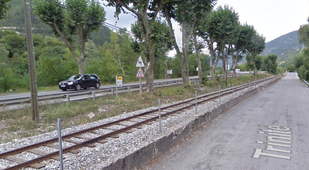
 Trinité bridge on the Var between Puget-Théniers and Entrevaux. [11]
 Trinité bridge, taken from the south side of the River Var.
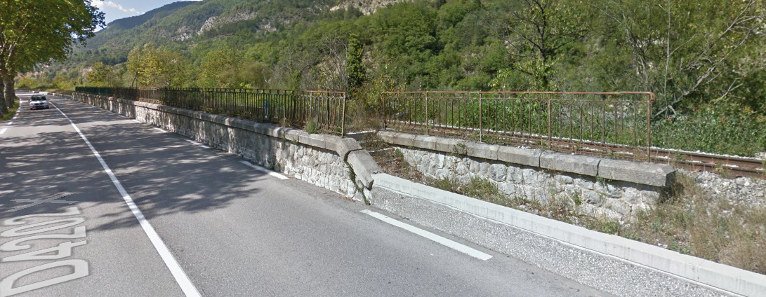
Once on the south side of the river, the railway and the road stay clos together. One year while staying in Nice, my wife and I took the train to Entrevaux and walked back along the line to Puget-Théniers. I remember the trees shading the road and the line really well. The picture below is typical of that length of the line.
 En-route to Entrevaux the line passes through an abandonned station (above), and as it gets closer to Entrevaux is crossed by the road at grade (below). The old cottage for the crossing-keeper still remains.
 A view of Entrevaux Station from the East.
 Entrevaux taken from a drone. The railway station can be seen on the right of the river and in the top half of the image. [24]


 Four historic images of Entrevaux Station and bridges above. [25]
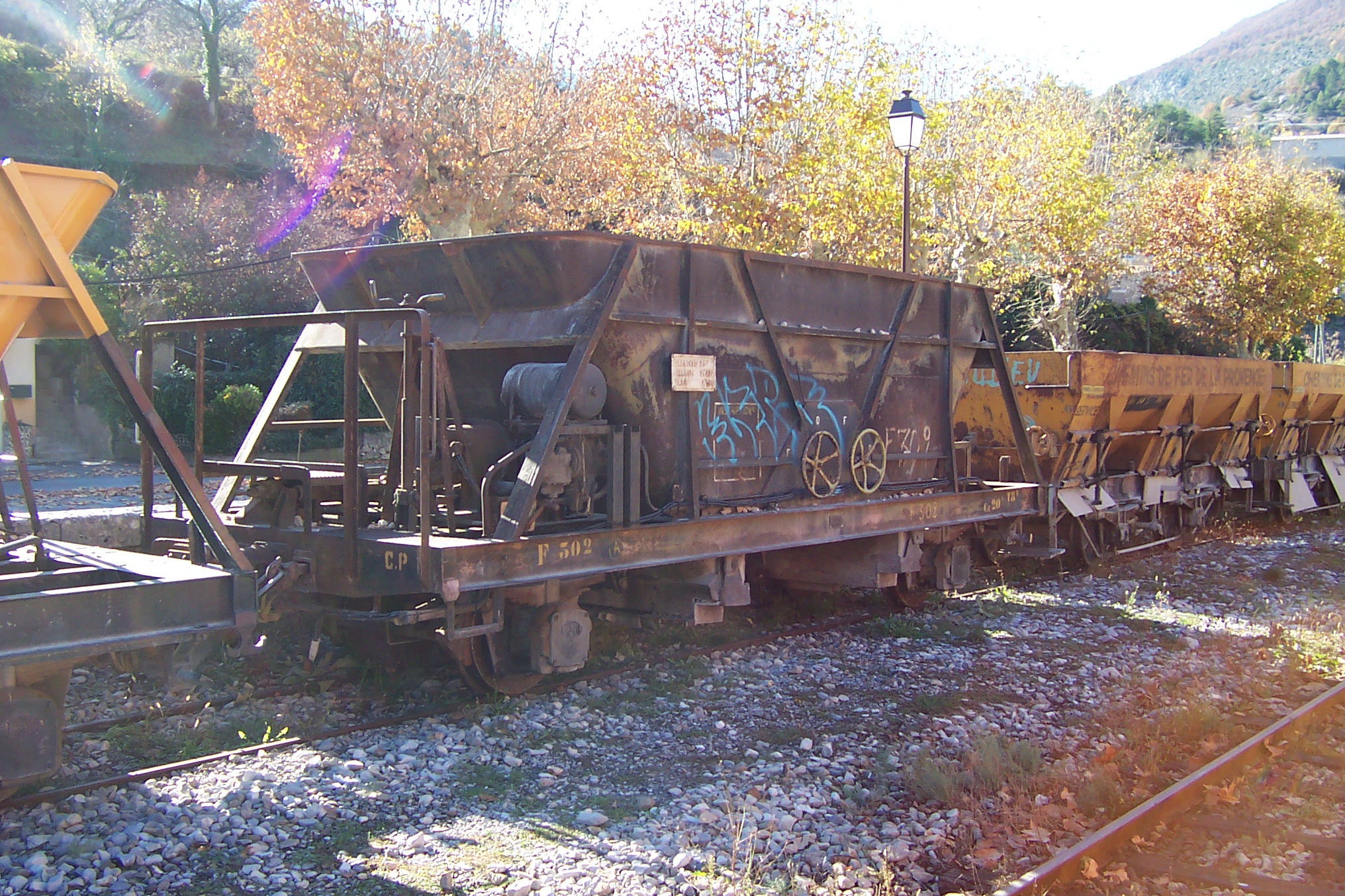
In 2011, my wife and I spent an hour or so sitting on the platform at Entrevaux Station, the following six pictures were among a number taken then.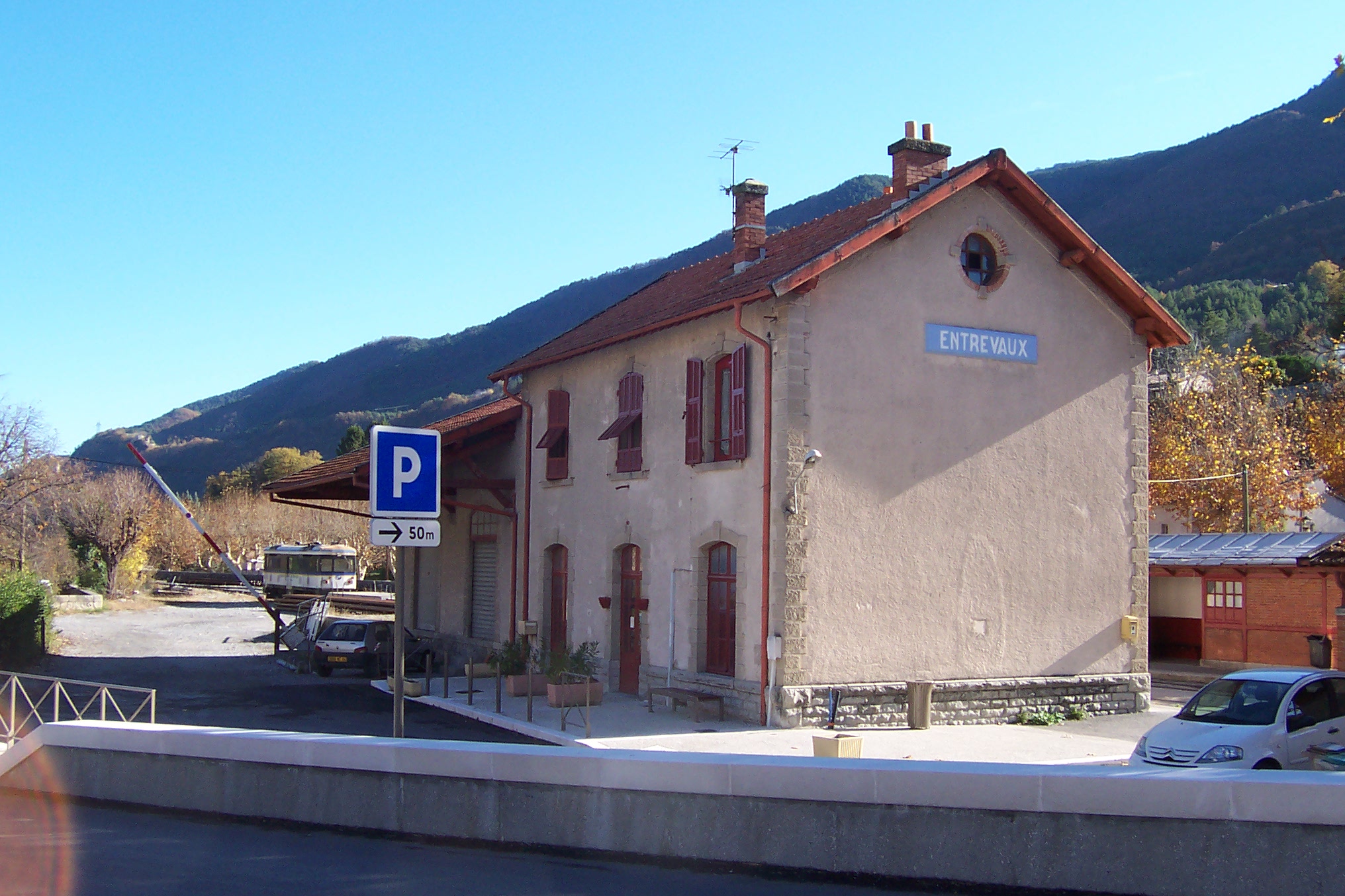


 Immediately after the railway station at Entrevaux the railway crossed a tributary of the River Var and plunged into a 164m long curved tunnel. The two pictures immediately above show the tunnel portal in the 21st Century and in the time of steam. The map below shows the tunnel highlighted in red, blue and green. A few tens of metres beyond the west portal of this tunnel, trains entered another tunnel, shown as black dots on the map which was 128m long. [26][27]
 The western portal of the first tunnel is quickly followed by the Eastern portal of the second tunnel.

 After the western portal of the second tunnel, the railway crossed the road once again at a level crossing and resumed a path close to, and on the south side of, the River Var.
 In the 21st Century, the crossing is automated, but the crossing keeper’s cottage remains a few tens of metres beyond the level crossing. While the road meanders away from the river, the railway line hugs the river bank as we travel on. After a few kilometres, road, rail and river converge once again after the railway has passed through a mall halt at Plan d’Entrevaux.
 Along the next length of track two interesting structures are encountered, both are visible in the picture above. These are false tunnels/aqueducts and have been given the nickname ‘Elephants’ because they bear some resemblance to an elephant. They provide for some relatively high water flows on two temporary streams. [28][29] Both are shown on the map below.
 The first encountered is marked with red and green dots, the second with black dots. These provide an interesting location for photographs, as can be seen below.

 After the ‘elephants’ the line swings more to the north following the course of the river and passes through another halt – Entrevaux-Agnerc. The halt immediately precedes another level crossing. The location of the halt, the crossing and the crossing keeper’s cottage can be seen below.
 The railway then dives into another tunnel – Tunnel des Cornillons. The tunnel is just 62m long and is marked with black dots towards the top-middle of the map above.
 The East Portal.
 The West Portal. [30]
 A steam train leaves the west portal of the tunnel on is way west. [30]
 The road crosses the River Var at this point (just north of the East Portal of the tunnel). The location is known as ‘Le Pont Noir’. The railway remains on the south side of the valley for another kilometre or so before reaching Le Pont Gueydan. The adjacent photograph shows the railway bridge as it was before 1994. The image immediately below shows the structure after the floods.


 The four images above show the new railway bridge installed after the floods of 1994. The Bridge spans the Le Coulomp. Just to the east of the bridge, the River Var turns sharply to the north and the railway follows the course of a tributary – Le Coulomp. The first station after the bridge is Saint Benoit Pont de Gueydan.

 This station was a junction station. The TAM ran a tramway north up the valley of the Var from Le Pont de Gueydan. It was the starting point of the tramway, which was often referred to as the Haut-Var tramway, which ran as far as Guillaumes.
This is the end of this stage of the journey.
References
- http://www.tunnels-ferroviaires.org/tu06/06078.1.pdf, accessed on 18th July 2018.
- http://cccp.traindespignes.free.fr/gare-malaussene.html, accessed on 18th July 2018
- https://trainmec.blogspot.com/2016/04/five-minutes-at-villars-sur-var-station.html, accessed on 11th July 2018.
- http://www.lecomtedenice.fr/Visi_nice/val_var_villars_sur_var_village.html, accessed on 19th July 2018.
- http://www.map-france.com/Villars-sur-Var-06710/photos-Villars-sur-Var.html, accessed on 19th July 2018.
- https://www.cparama.com/forum/villars-sur-var-t23761.html, accessed on 19th July 2018.
- https://www.delcampe.net/fr/cartes-postales/europe/france/06-alpes-maritimes/autres-communes?f=lieux:chemin-de-fer, accessed on 19th July 2018.
- https://dossiersinventaire.maregionsud.fr//gertrude-diffusion/dossier/gares-des-chemins-de-fer-de-provence/5db69410-c3ec-4217-b30c-92f975a65c27/illustration/66, accessed on 19th July 2018.
- http://cccp.traindespignes.free.fr/gare-touet.html, accessed on 19th July 2018.
- https://fr.m.wikipedia.org/wiki/Touët-sur-Var, accessed on 19th July 2018.
- https://www.cparama.com/forum/puget-theniers-t8978.html, accessed on 20th July 2018.
- https://www.geneanet.org/cartes-postales/view/271322#0, accessed on 20th July 2018.
- https://collection-jfm.fr/p/cpa-france-06-puget-theniers-222734, accessed on 20th July 2018.
- https://collection-jfm.fr/p/cpa-france-06-puget-theniers-vue-generale-pont-sur-le-var-carte-toilee-7207, accessed on 20th July 2018.
- http://www.collection-jfm.fr/p/cpa-france-06-puget-theniers-sur-la-route-des-alpes-et-sur-les-bords-du-var-171856, accessed on 20th July 2018.
- https://collection-jfm.fr/p/cpa-france-06-puget-theniers-la-place-et-la-roudoule-21338, accessed on 20th July 2018.
- http://cccp.traindespignes.free.fr/gare-puget.html, accessed on 20th July 2018.
- http://cccp.traindespignes.free.fr/phototheque-digne.html, accessed on 20th July 2018.
- http://www.beyond.fr/villages/puget-theniers-provence-france.html, accessed on 20th July 2018.
- https://www.gecp-asso.fr, accessed on 20th July 2018.
- https://trainmec.blogspot.com/2015/02/train-des-pignes-steam-train-winter.html, accessed on 20th July 2018.
- https://www.pinterest.co.uk/pin/356206651752278128/?lp=true, accessed on 1st July 2018.
- http://www.internationalsteam.co.uk/tales/francetales04.htm, accessed on 20th July 2018.
- http://www.dronestagr.am/citadelle-dentrevaux, accessed on 20th July 2018.
- https://www.cparama.com/forum/entrevaux-t17950.html accessed on 20th July 2018.
- http://www.tunnels-ferroviaires.org/tu04/04076.5.pdf, accessed on 20th July 2018.
- http://www.tunnels-ferroviaires.org/tu04/04076.4.pdf, accessed on 20th July 2018.
- http://www.tunnels-ferroviaires.org/tu04/04076.3.pdf, accessed on 21st July 2018.
- http://www.tunnels-ferroviaires.org/tu04/04076.2.pdf, accessed on 21st July 2018.
- http://www.tunnels-ferroviaires.org/tu04/04076.1.pdf, accessed on 21st July 2018.
- http://ollivier.haemmerle.free.fr/entrevaux.html, accessed on 21st July 2018.
